Background data

Hof HaCarmel Regional Council
Hof HaCarmel Regional Council was established in 1951 on an area of 190 dunam, and is today populated by about 29,000 residents who reside in 27 towns. The main employment fields are agriculture, tourism and industry in the Kibbutzim.
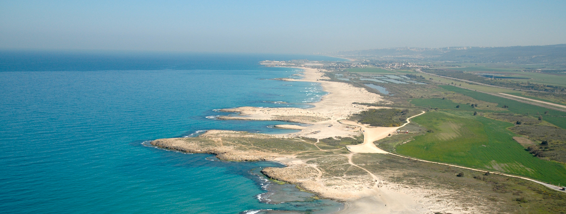
From aerial view you can see the coastline, about 40km full of bays, which begins in Kfar Galim in the north and continues until Sdot Yam in the south, and in the council’s eastern border the unique Carmel Ridge.
Our region prides itself in having magical landscapes of green open spaces, forests and nature reserves, fields and groves in a unique rural space.
Already in ancient times the area of Hof HaCarmel was an important crossroad. Around the council the remains of 500,000 years of civilization were found, from the prehistoric man, through the Phoenicians, the Romans, the Byzantines, the crusaders and up until today.
In 2012 Nahal Me’arot was proclaimed a site of universal value by UNESCO. It is one of a thousand universal sites and of the important ones. The Nahal Me’arot site contains evidence and findings of the most ancient settlement sequence found so far.
The Council towns
Beit Oren, Beit Hanania, Bat Shlomo, Geva Carmel, Dor, Habonim, Hahotrim, Yemin Orde, Kerem Maharal, Kfar Galim, Kfar Sitrin,
Megadim, Ma’agan Michael, Ma’ayan Tzvi, Neve Yam, Nahsholim, Nir Etzion, Ofer, Ein Ayala, Ein Hod, Ein Hawd, Ein Carmel, Atlit,
Tzrufa, Caesarea, Sdot Yam, Shfeya.